
EXTRACT HORIZONTAL AND VERTICAL ALIGNMENT INFORMATION FROM PUBLIC DATA AND OPEN API
PI: Xiaoming Yang
Co-PI(s): Russell Krenek, and David Scott
Institution(s): Georgia Southern University
Abstract
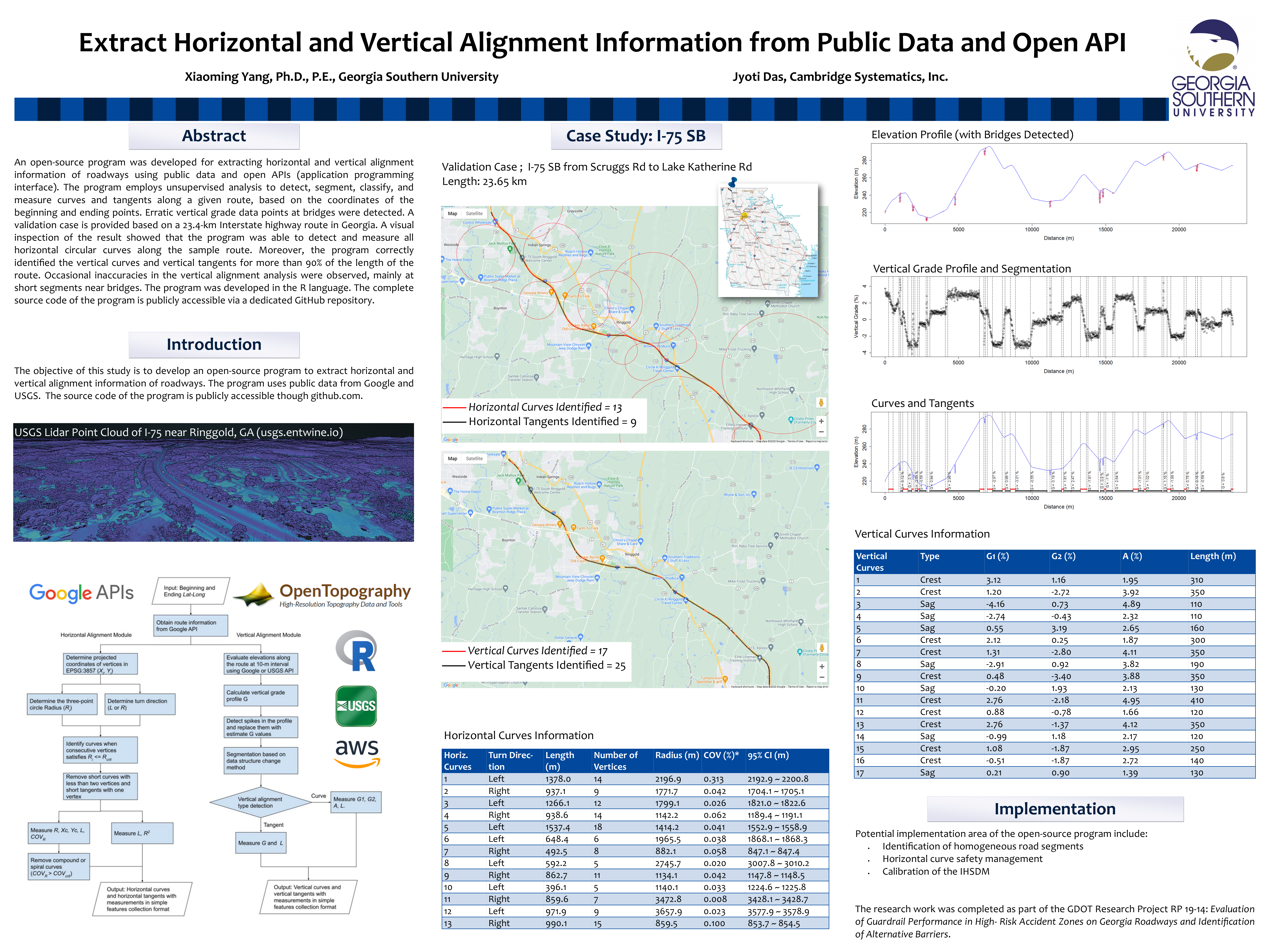
An open-source program was developed for extracting horizontal and vertical alignment information of roadways using public data and open APIs (application programming interface). The program employs unsupervised analysis to detect, segment, classify, and measure curves and tangents along a given route, based on the coordinates of the beginning and ending points. Erratic vertical grade data points at bridges were detected. A validation case is provided based on a 23.4-km Interstate highway route in Georgia. A visual inspection of the result showed that the program was able to detect and measure all horizontal circular curves along the sample route. Moreover, the program correctly identified the vertical curves and vertical tangents for more than 90% of the length of the route. Occasional inaccuracies in the vertical alignment analysis were observed, mainly at short segments near bridges. The program was developed in the R language. The complete source code of the program is publicly accessible via a dedicated GitHub repository.
Please comment below with any statements or questions you may have. Also let GTI if you would be interested webinars or presentations on similar topics.