
SATELLITE IMAGE AND REMOTE SENSING ANALYSIS FOR HIGHWAY ASSET MANAGEMENT
PI: S. Sonny Kim
Co-PI(s): Stephan Durham, Mi Chorzepa, Jidong James Yang, and Deepak Mishra
Institution(s): University of Georgia
Abstract
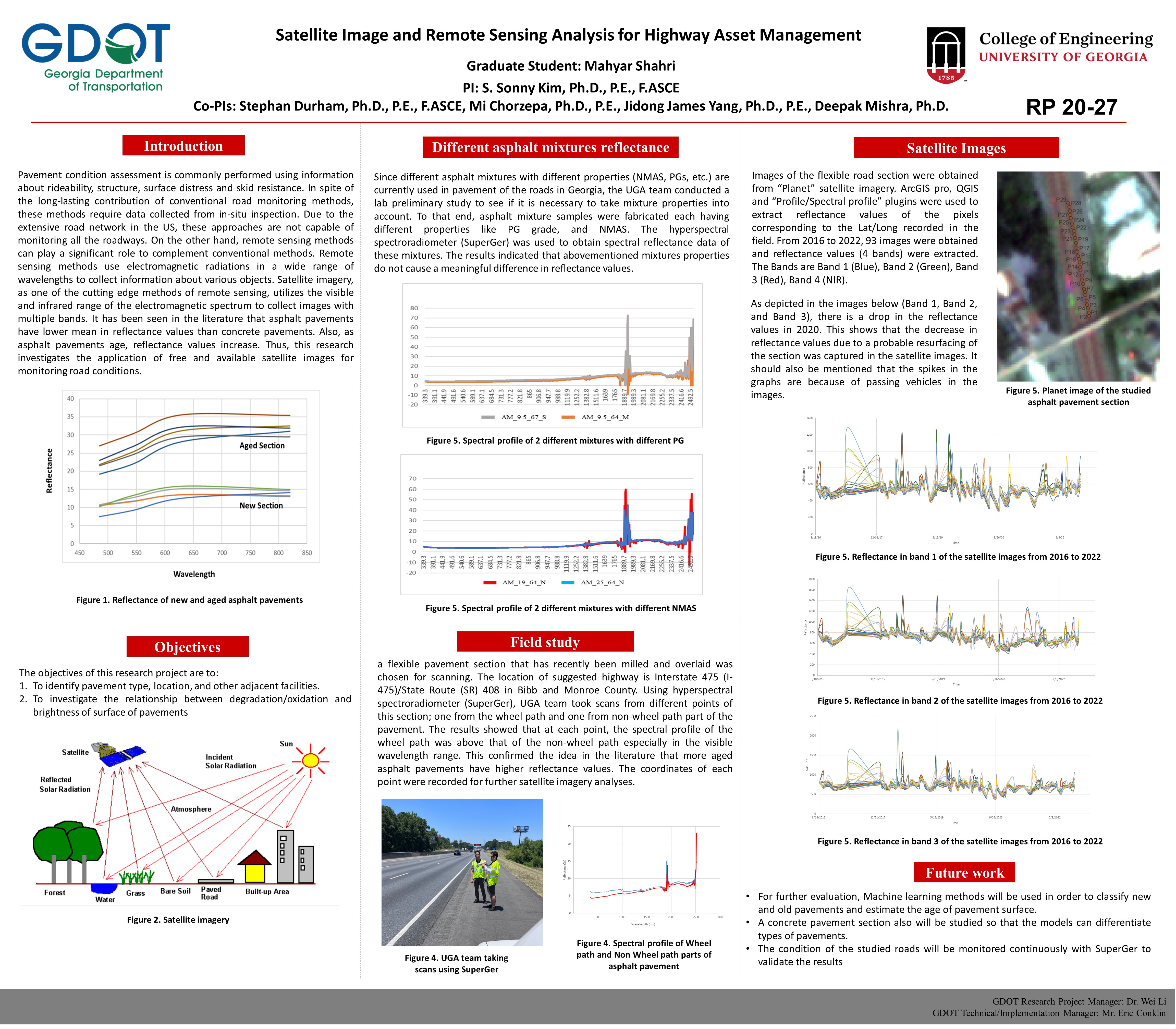
Pavement condition assessment is commonly performed using information about rideability, structure, surface distress and skid resistance. In spite of the long-lasting contribution of conventional road monitoring methods, these methods require data collected from in-situ inspection. Due to the extensive road network in the US, these approaches are not capable of monitoring all the roadways. On the other hand, remote sensing methods can play a significant role to complement conventional methods. Remote sensing methods use electromagnetic radiations in a wide range of wavelengths to collect information about various objects. Satellite imagery, as one of the cutting edge methods of remote sensing, utilizes the visible and infrared range of the electromagnetic spectrum to collect images with multiple bands. It has been seen in the literature that asphalt pavements have lower mean in reflectance values than concrete pavements. Also, as asphalt pavements age, reflectance values increase. Thus, this research investigates the application of free and available satellite images for monitoring road conditions.
Please comment below with any statements or questions you may have. Also let GTI if you would be interested webinars or presentations on similar topics.